Lat Krabang District (Lat Krabang)
Lat Krabang (literally translating to "slope of shield") is a second largest district of Bangkok (the first one is neighbouring district Nong Chok).
Neighbouring districts are (from the south clockwise): Bang Bo, Bang Sao Thong and Bang Phli (Samut Prakan province); Prawet, Saphan Sung, Min Buri and Nong Chok (Bangkok) and Mueang Chachoengsao (Chachoengsao province).
Two-thirds of the district is farmland. Another part is the industrial park and residential area. Therefore, it is filled with ditches and canals, Khlong Prawet Burirom is a main waterway. The identity of the district is that local culture and the way of life are based on canal culture, even now it is still local way of life since there is no road access in certain areas. Some people use boats and walkways along canal's bank.
At present, Lat Krabang is still considered one of the areas of Bangkok that still has rice cultivation as well as nearby districts were Min Buri and Nong Chok. In the past, some people traded rice by boat, they manually used big baskets for loading rice to their boats and unloaded it at the rice mill. They had workers and can only plant rice once a year. The harvest season is late November or December, it took a long time to manually harvest. There was no machinery back then. After harvesting, farmers had to carry them back so it would take six, seven or ten days of hard work. They worked so hard with some help from their buffaloes. Lat Krabang's rice fields consist of a wide of rice varieties.
The rowboat is an important local vehicle before 1992. Before that, anytime when someone died, those boats would be used to carry a coffin to the temple. It is also used as an important vehicle for other important religious ceremonies, such as ordaining monks.
In October 2005, the plan to create the special administrative area Nakhon Suvarnabhumi around Suvarnabhumi Airport became public. Lat Krabang was among the five districts that were to be included in this new administrative area.
Map - Lat Krabang District (Lat Krabang)
Map
Country - Thailand
 |
 |
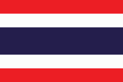
| Flag of Thailand | |
Tai peoples migrated from southwestern China to mainland Southeast Asia from the 11th century. Indianised kingdoms such as the Mon, Khmer Empire and Malay states ruled the region, competing with Thai states such as the Kingdoms of Ngoenyang, Sukhothai, Lan Na and Ayutthaya, which also rivalled each other. European contact began in 1511 with a Portuguese diplomatic mission to Ayutthaya, which became a regional power by the end of the 15th century. Ayutthaya reached its peak during the 18th century, until it was destroyed in the Burmese–Siamese War. Taksin quickly reunified the fragmented territory and established the short-lived Thonburi Kingdom. He was succeeded in 1782 by Buddha Yodfa Chulaloke, the first monarch of the current Chakri dynasty. Throughout the era of Western imperialism in Asia, Siam remained the only nation in the region to avoid colonization by foreign powers, although it was often forced to make territorial, trade and legal concessions in unequal treaties. The Siamese system of government was centralised and transformed into a modern unitary absolute monarchy in the reign of Chulalongkorn. In World War I, Siam sided with the Allies, a political decision made in order to amend the unequal treaties. Following a bloodless revolution in 1932, it became a constitutional monarchy and changed its official name to Thailand, becoming an ally of Japan in World War II. In the late 1950s, a military coup under Field Marshal Sarit Thanarat revived the monarchy's historically influential role in politics. Thailand became a major ally of the United States, and played an anti-communist role in the region as a member of the failed SEATO, but from 1975 sought to improve relations with Communist China and Thailand's neighbours.
Currency / Language
| ISO | Currency | Symbol | Significant figures |
|---|---|---|---|
| THB | Thai baht | ฿ | 2 |
| ISO | Language |
|---|---|
| EN | English language |
| TH | Thai language |


